Good condition
Topo: No topo :(
Elevation: 300m
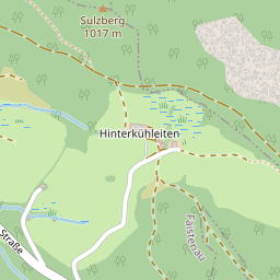
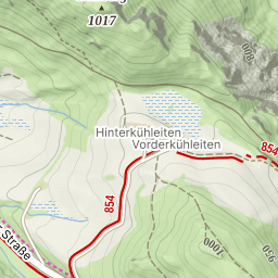
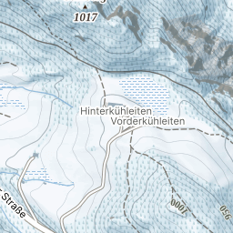
Parking: 45.3907°, 5.9409°
Ferrata: 45.3916°, 5.9544°


Characteristics
You'll first climb diagonally left before descending into the stream and crossing it via the "Poutres des Embruns".
The rest of the climb is made up of wooden ladders laid on the ground, and leads to the "Cascade Oubliée" footbridge, which is a real eye-catcher!
After this beauty, the via climbs diagonally to the right, from where you can admire the valley and the Chartreuse peaks towering above you.
All that's left is a succession of switchbacks (including the Vire du Pêcheur) before you find your way back down.
Arrival
Approach
It all starts with a 250m-high approach along the "Chemin d'Autrefois", which runs alongside the stream and takes you past the 2 Alloix waterfalls: the "Cascade de la Gouille Michel" and the "Grande Cascade".
This trail can be wet and very slippery, so don't go on in wet weather!
Descent
Take the path marked as difficult because it's the one you took on the way up - otherwise you can go back down the Roman road, but it's likely to take longer.
Points of interest
(Multiple authors)

 © 2026 Ferrata Guide