Good condition
Topo: No topo :(
Elevation: 100m
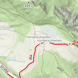
Parking: 45.3951°, 4.4483°
Ferrata: 45.3943°, 4.446°


Characteristics
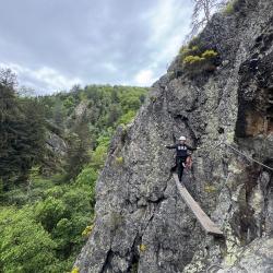
The whole trail is actually a canyon, the walk going over the cliffs overviewing the river below. The views are beautiful.
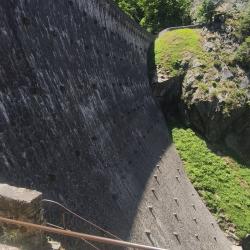
At some point you'd start seeing the dam and the tiroline line parallel to it. It's a great tiroline - have fun!!
Once you're on the other side, you climb to the peak of the rock and the VF is over.
Arrival
The route is very close to Saint Ettiene, a short drive and you're there, reaching a small parking lot ("Parking Gouffre d'Enfer" in Google Maps) at the end of the road.
Approach
From the parking lot, head towards the woods in a nice trail by the river (which is on your right). Soon you'll start climbing up the hill, and after about 10 minutes, you'll get to a hanging wooden platform, from where the trail starts.
Descent
Walking back to the parking lot is all the way down and takes about about 20 minutes.
Points of interest
1. "Barrage du Gouffre d'Enfer" - the dam.
2. A nice view point on the way back, which starts here: https://maps.app.goo.gl/eXbAmdZKpTfvcGvy7
You can wash your feet in the stream before you continue back.
(Multiple authors)

 © 2026 Ferrata Guide