Predicting whether..
Elevation: 14m
Parking: 50.3306°, 12.5102°
Ferrata: 50.3383°, 12.5166°


Characteristics
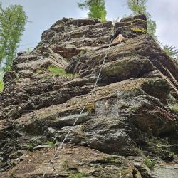
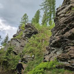
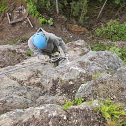
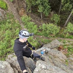
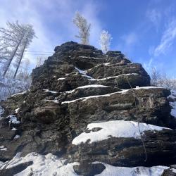
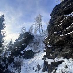
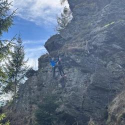
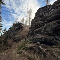
A cozy via ferrata area has been set up on the rocky outcrop called Hausberg, which offers a total of three routes (marked with different colors). These extend over three smaller rocks. In the middle of the area rises what is probably the most dominant structure with a viewing area. We get to this summit via two routes. After a while, the blue route (A,B) splits into the black route (C/D), which in turn joins at the suspension bridge. Via this bridge we reach the outermost peak, from where an easy route leads to the view. On the last peak we find the technical red route (C), which runs at a low height from the ground and suddenly becomes very interesting if you don't use the rope.
The blue route begins with small overhangs, then we move along an interesting wall at a low altitude, where we have to look for the holds ourselves. Plates and other interesting sections follow until we reach the summit. We circle around it and then walk gently down to the suspension bridge.
The black, shorter route is rated D, but it is more of an easier route that climbs steeply. You can park at the Protestant church where there is enough space. Then we follow the forest path on the red path, which gradually connects with the miners' path (NS Stopami horníků).
Arrival
The tourist route leads to the view. The start of the blue route is below the main rock, which we can reach via a path on the right side of the view. On the way we pass the entrance to the red route.
Boarding
Due to the small size of the area, almost all routes end at the summit.
Exit
Interesting facts
At the summit are the ruins of Hausberg Castle (Greslein), which lies above the Svatava River. It was documented in 1272. After its conquest in 1412, it was used by robbers and was abandoned and mined for building materials in the second half of the 16th century. Coordinates: 50.3382266N, 12.5159544E
(Multiple authors)

 © 2026 Ferrata Guide